Mining & Exploration
How are drones used in mining?
- Potential mining sites exploration: When equipped with the right imaging and sensing technologies, drones can capture high-resolution images and data, providing detailed information about the geological features and mineral composition of the site that can be used to assess the feasibility and potential value of a site before committing to a full-scale project.
- Automate inventory management: Drones can automate inventory management such as planning material replenishment, optimizing storage space, and scheduling transportation, by streamlining and improving various aspects of the process, including data collection, data processing, and report delivery.
- Stockpiles’ volumes measurement and management: The data provided by the drone can be processed using photogrammetry software to create accurate 3D models of stockpiles to calculate stockpile volumes with a high degree of accuracy. That helps identify potential issues, such as uneven settling, erosion, or contamination, which may affect the quality or safety of the stockpiles.
- Drills and blasts planning and monitoring: Drones can generate detailed, real-time information about drill patterns, hole alignments, and overall progress. It can also capture aerial imagery and videos of blasting operations, providing valuable insights into blast patterns, fragmentation, and muck pile formation. This data can be analyzed to evaluate the efficiency of blasting techniques, identify potential issues, and facilitate improvements in blast design. Post-blast drone surveys can also help in assessing the stability of high walls and the safety of the surrounding area.
- Water flow monitoring: Effective water management is crucial in mining operations to prevent environmental damage and ensure regulatory compliance. Drones can be used to monitor water flow in and around mining sites, capturing data on water levels, flow rates, and potential contamination, and identifying areas of concern, such as erosion, sedimentation, or changes in water quality to implement appropriate mitigation measures and maintain sustainable water management practices.
- Security and situational awareness enhancement: Drones equipped with high-resolution cameras and thermal imaging can monitor site perimeters, detecting potential intrusions or unauthorized activities and identifying potential hazards or unstable conditions before they pose a threat to workers. In the event of an emergency, such as a fire or a hazardous material spill, drones can provide real-time information on the situation, allowing for a more rapid and effective response.
- Mine reclamation planning and execution: Drones can help monitor and measure the environmental conditions and footprint during and after mining operations, ensuring proper rehabilitation and minimizing damage to the ecosystem.
Benefits of Using Drones in Surface Mining and Open Pit Mining
- Cost-Effectiveness: The use of drones can significantly reduce operational costs. Traditional surveying and inspection methods often require expensive equipment and a large workforce. In contrast, drones are relatively affordable and can complete these tasks faster and with fewer human resources.
- Enhanced Safety: Drones can access hazardous and hard-to-reach areas in mines without putting human lives at risk. By reducing the need for workers to perform dangerous tasks, such as inspecting unstable slopes or monitoring gas leaks, drones can enhance overall safety in mining operations.
- Improved Efficiency: Drones can perform tasks faster and accurately than traditional methods. By providing real-time data and insights, drones enable mining companies to make informed decisions and optimize their operations, ultimately improving efficiency and productivity.
- Reduced Environmental Impact: Drones can help mining companies monitor and mitigate their environmental impacts. By identifying potential hazards and monitoring the progress of rehabilitation efforts, drones can contribute to the sustainable development of mining operations.
What are the expected data outputs of mining drones?
- Orthomosaic Raster: A two-dimensional composite aerial image created from multiple overlapping drone-captured images called orthophotos that have been corrected so that the scale to the earth’s actual surface is uniform throughout the deliverable. It is usually georeferenced and accurately aligned to create a seamless, high-resolution map of an area. The orthomosaic map can be used for various applications such as land surveying, agriculture, urban planning, and construction.
- 3D point cloud: A set of data points in three-dimensional space. It is composed of points that are defined by their x, y, and z coordinates, along with additional data such as color, intensity, or range. When transformed into pixels and placed together to form a “cloud,” these points provide a rough outline of the surveyed area. It is typically used to measure distance, objects, areas and volumes in terms of depth, height and much more.
- Digital elevation models (DEM): A digital representation of elevation data of a physical landscape, usually in the form of a three-dimensional array of evenly spaced points that represent the terrain heights. The data used to create DEMs includes elevation points taken from satellite imagery, aerial photographs, and other sources.
- 3D textured mesh: A 3D model that is made up of a set of connected triangular polygons or faces that have a texture (the surveyed terrain’s visual presentation) applied to its surface (the surveyed area’s shape) to add more detail and realism. This texture can be a photograph, a pattern, or any other type of image that is mapped to the 3D model’s surface.
- Contour lines: An intricate network of mapped lines used to illustrate the shape, elevation, and landforms of an area, with each line representing an elevation change such as sea level or the height of a mountain. They are typically shown in brown or black, with heavier lines representing higher elevations.
What is the best drone to use for the mining & metals industry?
Choosing the right mining drone involves considering several factors to ensure it meets the specific requirements of your mining operations. Here are some key aspects to consider when selecting your mining drone:
- Payload capacity and compatibility: The drone should be able to carry the necessary sensors and cameras, such as LiDAR, multispectral, or high-resolution cameras, that are required for your mining surveying tasks.
- Flight time: Longer flight times allow for larger area coverage and minimize the need for frequent landings and battery changes. Choose a drone with an adequate flight time to efficiently cover your mining site.
- Range and communication: The drone’s range should be sufficient to cover the mining area without losing communication with the remote controller. Also, consider the communication system’s reliability and resistance to signal interference.
- Stability and wind resistance: Mining sites can have challenging weather conditions. Choose a drone with good stability and wind resistance to ensure accurate data capture and safe operation in varying conditions.
- GPS accuracy: High GPS accuracy is essential for precise geolocation of the captured data. Opt for a drone with RTK (Real-Time Kinematic) or PPK (Post-Processed Kinematic) capabilities for improved positional accuracy.
- Automation and flight planning: Advanced flight planning software and automation features make it easier to conduct repetitive surveying tasks, pre-plan missions, and optimize flight paths.
- Safety features: Select a drone with built-in safety features such as obstacle detection, automatic return-to-home, and geofencing to minimize the risk of accidents and damage.
- Regulatory compliance: Ensure the drone complies with local aviation regulations, including weight, altitude, and operational restrictions.
- Support and training: Opt for a drone manufacturer that offers reliable customer support, training, and maintenance services to keep your drone operational and up-to-date.
- Budget: Consider the drone’s cost, including initial investment, maintenance, and operational expenses, to ensure it fits within your project budget.
By evaluating these factors, you can choose the most suitable mining drone that meets your operational requirements, and budget, and ensures efficient and accurate data collection for your mining surveying tasks.
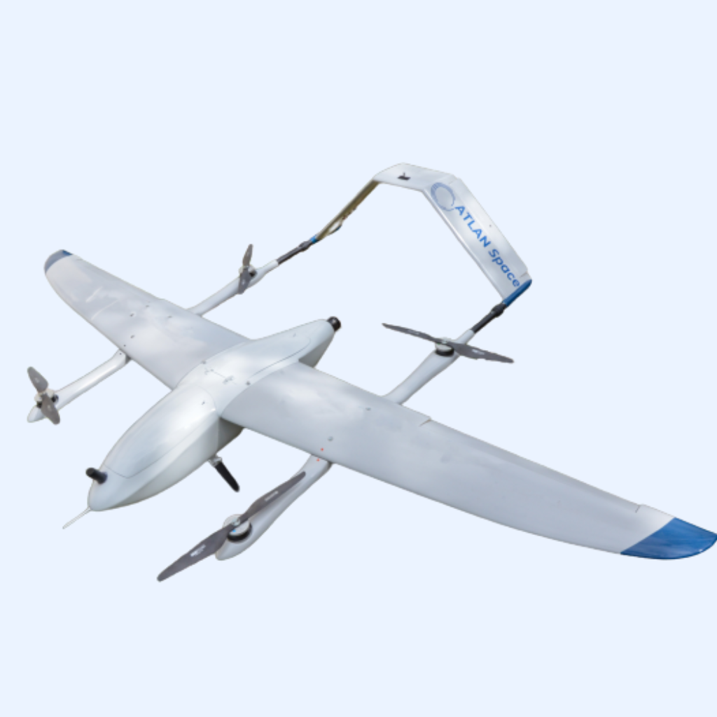
Click here to check out our drone for mining and aggregates: ATLAN Geo.
What is the post-processing software that you can use?
The best post-processing software for mining surveying is the one that meets your mission requirements and is compatible with your drone and its data format. Compatibility is crucial for seamless integration and efficient data processing. In addition to compatibility, consider the following factors when choosing the right post-processing software for your mining surveying project:
- Functionality: Ensure the software offers the necessary tools and features for your specific mining surveying needs, such as generating orthophotos, 3D models, point clouds, and performing volumetric analysis.
- Ease of use: The software should be user-friendly and intuitive, making it easy for surveyors and engineers to process, analyze, and visualize the drone data.
- Integration with other systems: The chosen software should integrate seamlessly with your existing GIS, CAD, and other relevant systems, allowing for efficient data sharing and collaboration.
- Technical support and updates: Opt for software that offers reliable technical support and regular updates to keep up with the latest industry standards and technology
- Cost: Consider your budget and the software’s pricing model to ensure it fits within your project’s financial constraints.
By taking these factors into account, you can select the best post-processing software for your mining surveying project.
ATLAN Geo is compatible with most post-processing software including but not limited to (insert these software logos) Pix4D, ODM, Agisoft Metashape, 3DF Zephyr, Bentley Context Capture, Simactive Correlator3D, DroneDeploy, Elcovision 10, Photomodeler.
Related Solutions
Similar Articles
Atlan update brings first-ever safe RTH and more
Lorem ipsum dolor sit amet consectetur. Duis libero et lorem morbi eget commodo et elementum mi. Auctor interdum egestas phasellus.


Atlan update brings first-ever safe RTH and more
Lorem ipsum dolor sit amet consectetur. Duis libero et lorem morbi eget commodo et elementum mi. Auctor interdum egestas phasellus.


Atlan update brings first-ever safe RTH and more
Lorem ipsum dolor sit amet consectetur. Duis libero et lorem morbi eget commodo et elementum mi. Auctor interdum egestas phasellus.


Atlan update brings first-ever safe RTH and more
Lorem ipsum dolor sit amet consectetur. Duis libero et lorem morbi eget commodo et elementum mi. Auctor interdum egestas phasellus.
Automatic Sense and Avoid for Remotely Piloted Aircraft Systems (RPAS)


Please fill form to download whitepapers
Your operators will know how to deploy
ATLAN GEO in just a few days of online training
Get in touch with us
Contact ATLAN Space to :
Stay up to date
Subscribe to newsletter for latest news & updates.
ATLAN Space Solutions
About us
- Company
- Contact Us
- Become A Distributor
- Press Media/Kits
- Warranty
Industry solutions
- Land-Surveying & GIS
- Mining & Exploration
- Ocean Monitoring
- Agriculture
- Oil And Gaz
- Environment & Disaster Assessment
- Construction & Infrastructure
- Cargo Delivery
Knowledge Base
- Resource
- News & Events
- White Papers
- Blogs
- Webinars
- Privacy Policy
- Copyright © 2023 Atlan Space All rights reserved.


